Easily design your surveys, evaluate the performance of your survey systems, etc...


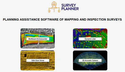
SURVEY PLANNER is a planning assistance software of mapping and inspection surveys using :
- Multibeam echosounders,
- Dynamic Lidars,
- Side scan sonars and,
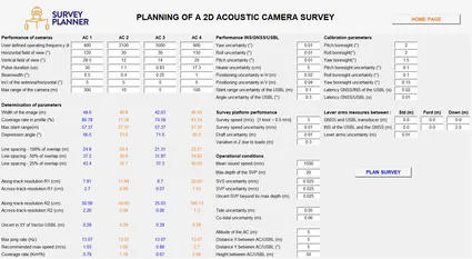
- 2D acoustic cameras.


If you need more information or a quote about Survey Planner, please
It was specifically designed to help the various stakeholders of the hydrographic and topographic communities (professionals, institutions, infrastructure owners, equipment suppliers and manufacturers, design offices, etc...) to:
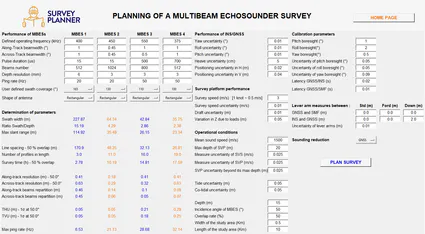
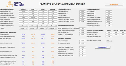
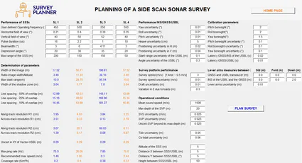
- Easily find a suitable survey system and an optimal set of parameters (calibration parameters, navigation parameters, operational parameters, etc.) during the survey projects planning ,
- Quickly and easily evaluate and compare global performances of four (4) survey systems (data resolution and density, system error budget, survey time, swath width, number of profiles, etc.) ,
- Control the performance of integrated survey systems announced by service providers, suppliers and manufacturers of equipments dedicated to mapping, and inspection.
SURVEY PLANNER is portable, practical and easy to use software. It does not require installation beforehand to operate. It has been developed by Geraud NAANKEU WATI , Positionning and Geomatic Specialist and Author of "Basics of Hydrography and Inspection of Subsea Infrastructures - Principles and Practice, 1st Edition".
Click to enlarge
Free service easy and accessible to everyone
Follow me !
Contact me !
gnw.bhi@gmail.com
+33 660 12 82 33
Follow me !
Contact me !
info.surveyplanner@gmail.com
+33 6 60 12 82 33